Italy · 45.4375°, 12.3358°
Venice Map Poster: The Grand Canal and the Lagoon
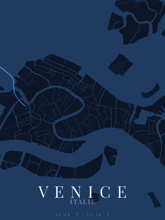
Why this city works as a poster
Venice is the only city whose map reads first through water: the lagoon surrounds everything, and the Grand Canal crosses the city in a reversed S almost four kilometres long. The historic centre has the shape of a fish lying on the lagoon, the Giudecca stretches to the south like a long band, and the Ponte della Libertà runs dead straight to the mainland. The streets are so fine that they form a weave, almost a texture, around the canals.
Recommended framing
About 5 km across to hold the whole "fish", the Giudecca and the start of the bridge: the lagoon then frames the city on every side. At 1.5 km around the Rialto, the Grand Canal and its bridges become the subject.
Which theme to pick
A theme that draws pedestrian paths, or the "Paths" option switched on when the theme offers it: in Venice almost every street is pedestrian, and without them the city shrinks to its canals. The water, which covers half the poster, needs a strong colour.
Where to centre the map
- Grand Canal
- The reversed S crossing the whole city: the poster's master line.
- Rialto
- In the middle of the Grand Canal, the oldest of its bridges and the densest district.
- Giudecca
- The long island to the south, separated from the city by a wide canal: it closes the composition.
How its streets are oriented
Within 3 km of the centre, we measured the orientation of 185 km of streets. Its orientation order is 0.02 out of 1: Venice ranks 58th of the 64 cities in the study.
The streets run in almost every direction: no axis dominates, the pattern is organic.
See the full study: street orientation in 64 cities