France · 45.7640°, 4.8357°
Lyon Map Poster: The Rhone-Saone Confluence
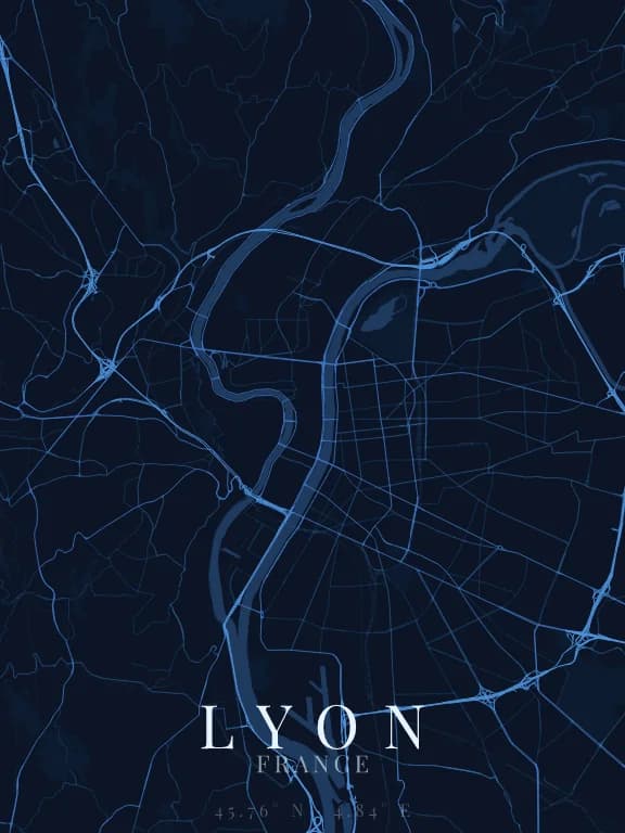
Why this city works as a poster
Lyon is one of the few large cities whose shape comes from two rivers rather than one. The Rhone and the Saone run down in parallel before meeting in the south, enclosing a long narrow strip of land between them. That peninsula gives the poster a strong vertical axis few cities offer naturally.
Recommended framing
Frame vertically, about 8 km north to south, with the confluence in the lower third of the poster rather than at the centre. Centred, the meeting point of the two rivers loses its force; low, it closes the composition.
Which theme to pick
A theme where water is clearly differentiated from roads works better here than elsewhere, since water is the subject. Avoid monochrome themes, which would reduce both rivers to slightly wider streets.
Where to centre the map
- Presqu'île
- The strip between the two rivers, with a regular grid that cuts against the surrounding hills.
- Vieux Lyon
- Narrow streets at the foot of Fourviere: the linework becomes much finer, almost a texture.
- Confluence
- The southern tip. Framed alone at 2 km, it gives a very identifiable prow shape.
How its streets are oriented
Within 3 km of the centre, we measured the orientation of 467 km of streets. Its orientation order is 0.13 out of 1: Lyon ranks 18th of the 64 cities in the study and 4th of the 25 French cities.
A few directions dominate without forming a grid: the pattern mixes districts of different eras and plans.
See the full study: street orientation in 64 cities