France · 43.6047°, 1.4442°
Toulouse Map Poster: The Garonne, the Canal, the Pink City
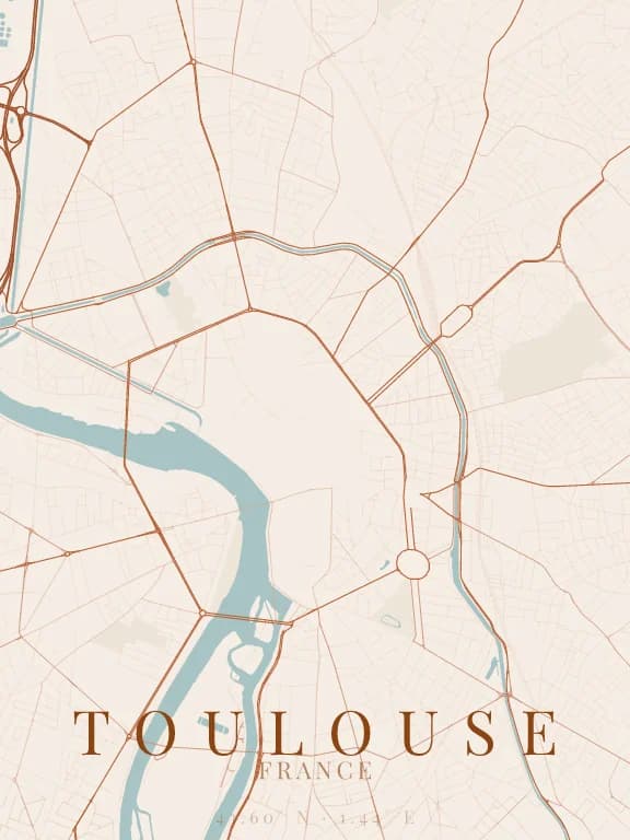
Why this city works as a poster
Toulouse has neither a grid nor a main axis: its streets run in every direction from the Capitole, which gives its map the texture of a fingerprint. Two lines of water still hold the composition together: the Garonne, wide and curving, west of the centre, and the Canal du Midi, which skirts the city to the north and east and joins the river at the Ponts-Jumeaux through the Canal de Brienne. Between them, the ring of boulevards follows the line of the old ramparts.
Recommended framing
About 6 km across, centred on the Capitole, keeps the curve of the Garonne, the ring of boulevards and the arc of the canal in one image. At 2 km the ring of boulevards becomes the subject: a dense, almost round core edged by wide avenues.
Which theme to pick
A warm theme in the terracotta family echoes the brick of the Pink City. Make sure the Garonne stays a clearly visible flat area: it is the only large landmark in a network with no dominant direction.
Where to centre the map
- Capitole
- The centre of the circle. The old streets converge on it with no apparent order, which makes a very dense poster centre.
- Ponts-Jumeaux
- The Canal du Midi, the Canal de Brienne and the Canal latéral à la Garonne meet here: three lines of water in a star.
- Île du Ramier
- South of the centre the island splits the Garonne into two arms: a lower frame gains a singular water shape.
How its streets are oriented
Within 3 km of the centre, we measured the orientation of 464 km of streets. Its orientation order is 0.01 out of 1: Toulouse ranks 64th of the 64 cities in the study and 25th of the 25 French cities.
The streets run in almost every direction: no axis dominates, the pattern is organic.
See the full study: street orientation in 64 cities