United States · 40.7128°, -74.0060°
New York Map Poster: The Manhattan Grid
Why this city works as a poster
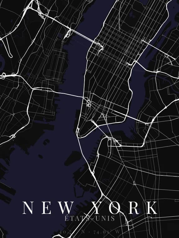
Manhattan is the exact inverse of Paris: a strict grid, no stars, no radial avenues, whose interest comes precisely from the three things that break it. Central Park cuts an empty rectangle through the middle, Broadway crosses it diagonally south to north, and the island tapers to a point in the south. A grid alone would be monotonous; those three accidents make the poster.
Recommended framing
Portrait is the only orientation that fits: the island is three times taller than it is wide. A frame on the whole of Manhattan, about 20 km north to south, keeps both the park and the southern tip in one image. Below 5 km the grid turns monotonous again.
Which theme to pick
A theme that distinguishes parks from everything else — otherwise Central Park vanishes and the map loses its main landmark. Themes that treat green space as background are the wrong choice here.
Where to centre the map
- Central Park
- The empty rectangle. It gives scale to everything else on the poster.
- Lower Manhattan
- South of Houston the grid gives way to an older, irregular network.
- Brooklyn Bridge
- Framing on the East River shows the bridges, the only lines that cross the water.
How its streets are oriented
Within 3 km of the centre, we measured the orientation of 379 km of streets. Its orientation order is 0.85 out of 1: New York ranks 1st of the 64 cities in the study.
The streets follow a clear grid: two perpendicular directions carry most of the network. The main grid is tilted 28° east of north.
See the full study: street orientation in 64 cities