Spain · 41.3874°, 2.1686°
Barcelona Map Poster: The Eixample Grid
Why this city works as a poster
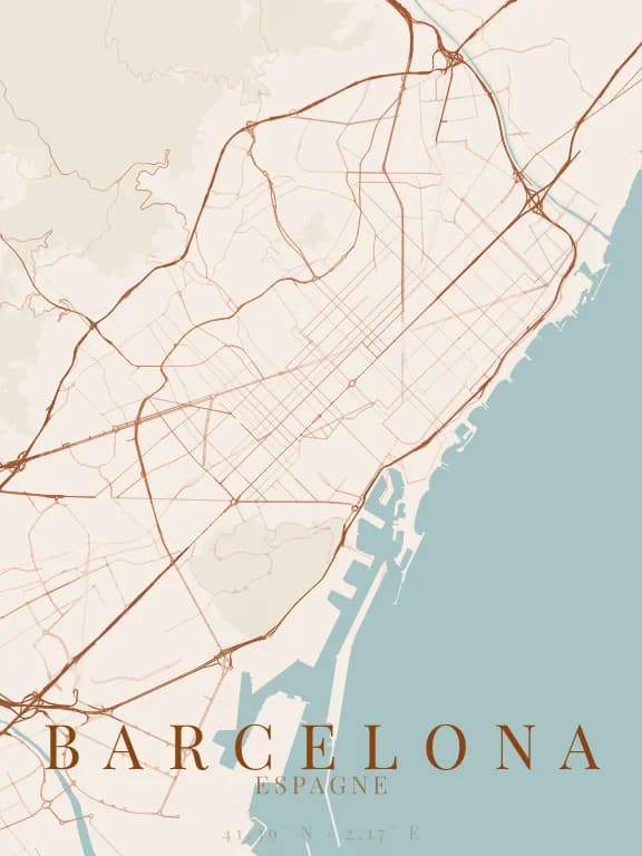
The Eixample is not an ordinary grid: every intersection is cut on the diagonal, which on the map produces a texture of repeated octagons rather than squares. At reading distance that texture reads as a regular, almost textile pattern — an effect no other major city produces.
Recommended framing
Frame at 5 km, including the Diagonal, the avenue that crosses the grid on the slant. Without it the texture is beautiful but uniform; with it the composition gains an axis and a break.
Which theme to pick
The octagon pattern only survives fine linework. Themes with heavy roads turn the Eixample into a uniform block and remove exactly what makes the map interesting: check this on the free preview before buying.
Where to centre the map
- Eixample
- The chamfered-corner grid, the poster's main subject.
- Ciutat Vella
- The old town, whose irregular network cuts sharply against the neighbouring grid.
- Diagonal
- The slanted avenue, the only line that does not obey the grid.
How its streets are oriented
Within 3 km of the centre, we measured the orientation of 522 km of streets. Its orientation order is 0.33 out of 1: Barcelona ranks 11th of the 64 cities in the study.
A grid stands out, but a good share of the streets run in other directions. The main grid is tilted 42° west of north.
See the full study: street orientation in 64 cities