France · 43.2965°, 5.3698°
Marseille Map Poster: Coastline and Old Port
Why this city works as a poster
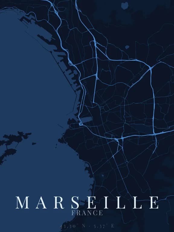
The coast decides everything: it occupies the left or bottom edge of the poster depending on orientation, and the city unfolds against it. The Old Port notches that line with a clean rectangle, an artificial shape in the middle of an irregular coast. That contrast between natural jaggedness and the port's right angle is what makes the map instantly legible.
Recommended framing
Do not centre on the Old Port: shift it toward the left third so the city can spread to the right. A wide 12 km frame also catches the start of the calanques to the south, whose jagged edge is the most graphic part of the map.
Which theme to pick
A theme with strong contrast between water and land. Water occupies a significant share of the surface here: if its tone sits too close to the background, the poster loses its shape and stops looking like Marseille.
Where to centre the map
- Vieux-Port
- The rectangle of water at the city's heart, ringed by a dense grid.
- Calanques
- To the south, a coast cut with coves. Framed alone it gives a map more abstract than urban.
- La Canebière
- The straight axis running east from the port, one of the few rectilinear lines on the map.
How its streets are oriented
Within 3 km of the centre, we measured the orientation of 394 km of streets. Its orientation order is 0.10 out of 1: Marseille ranks 27th of the 64 cities in the study and 6th of the 25 French cities.
A few directions dominate without forming a grid: the pattern mixes districts of different eras and plans.
See the full study: street orientation in 64 cities